

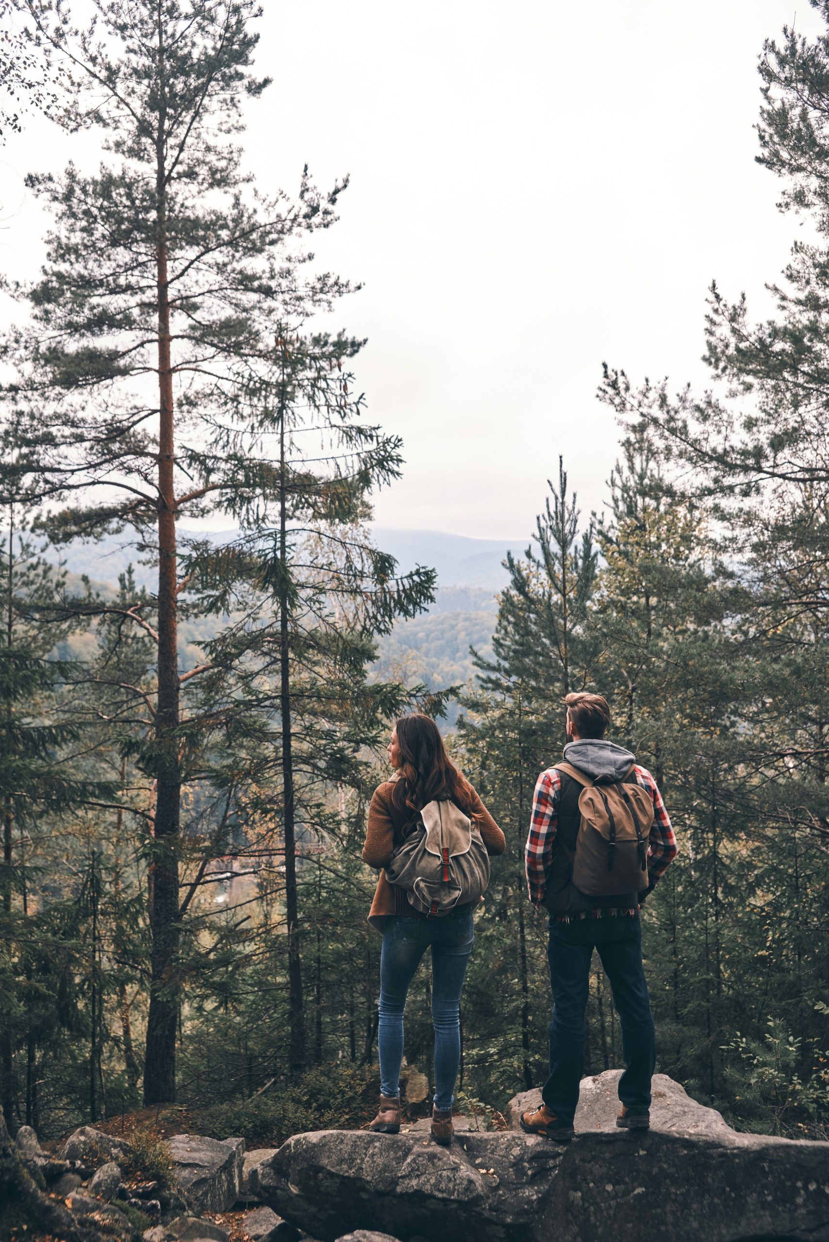
The Full Loop · On Foot
Hike the Full HMR Loop
The signature experience — all 24 historic sites in one counterclockwise loop.
Route Overview

The route is well-marked with wayfinding signs that show the official logo of the Park City Historic Mine Route: a stylized mine car filled with silver ore.
The full loop is about 7 miles, with a bit over 1,200 feet of elevation gain, and should take a minimum of 3.5 to 4.5 hours to hike. The loop starts at the Park City Museum, 528 Main Street — site #1 on the map — and travels counterclockwise, heading north and west from the Museum and finishing back at the Museum. Using the capability levels for hiking routes established by Park City Mountain Sports Club, this 7-mile route is a Moderate Plus (+) hike. Semi-moderate and Easy hike options are available for people of differing capabilities.
Surface:
Paved road and sidewalk from historic sites #1 to #4, gravel roads and single-track dirt trails from #5 to #21, paved road and sidewalk from #24 back to the Museum.
Trails on this route
Plus city streets and sidewalks at the start and finish. Ratings follow Mountain Trails Foundation maps.
Turn by Turn
The Route, Step by Step
01
Main Street to the Town Lift Overlook
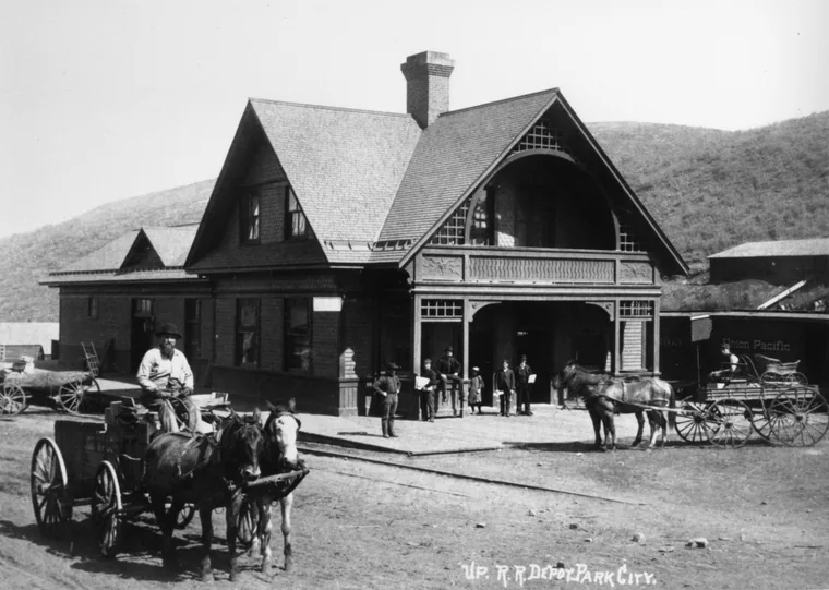 The Union Pacific Depot, at Main Street & Heber Avenue.
From the Museum, walk north on Main Street to Heber Avenue where the first site of historical interest will be found, Union Pacific Depot 2. Turning left on Heber Avenue one block to Park Avenue will be the Crescent Tramway 3. Continue on the walk, which can be recognized by the rail-looking marks in the sidewalk, up to Empire Avenue where a left turn will take you to the Ol’ Miner Statue 4 on Lowell Avenue. A short distance on, more description of what to expect on the hike will be shared at the Treasure Hill Trailhead 5, before arriving at the Town Lift Overlook 6 where the story of the Silver King Coalition Mine and tram will be introduced.
02
Up Sweeney's Switchbacks
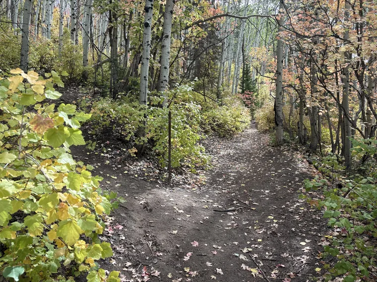 Single-track climbing through the forest on Sweeney's Switchbacks.
Continuing up the Sweeney’s Switchbacks Access dirt road to the right turn onto Sweeney’s Switchbacks trail will be the beginning of the single-track dirt trails on the Historic Mine Route. The Sweeney’s Switchbacks trail is rated Intermediate on Mountain Trails Foundation’s maps until just after its second intersection with the Mother Urban trail, after which it is rated Difficult.
The Creole Mine and Ski Jump 7 site will be reached about ¾ of a mile up Sweeney’s Switchbacks, and an abandoned mine’s Waste Rock Dump 8 another ½ of a mile uphill. Sweeney’s Switchbacks is simply called the Sweeney’s trail shortly beyond #8, the Waste Rock Dump. Follow the wayfinding signs to John’s trail which leads to the next historic story site, the Silver King Aerial Tram 9, which is at an intersection of John’s and the Trestle trail. Trestle becomes a Hikers Only trail from this point uphill. Bike riders can continue on John’s trail all the way up to Drift Road near the top of the Town Lift and rejoin the Historic Mine Route.
03
Trestle to the Silver King
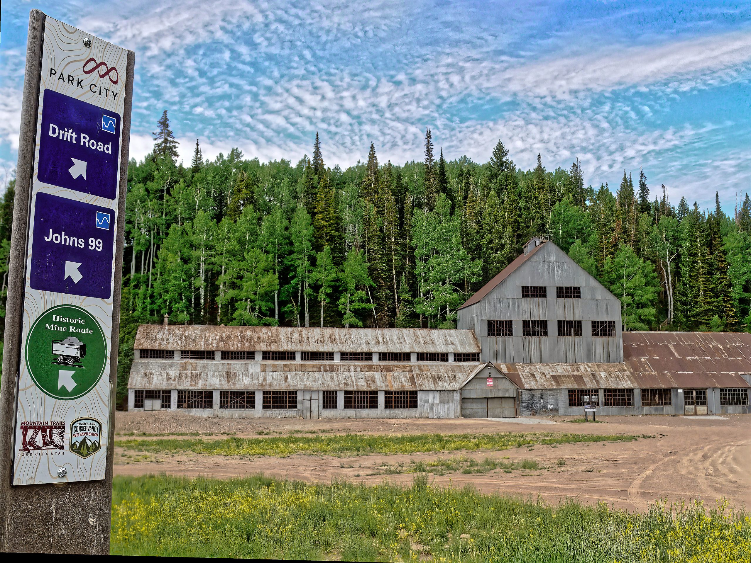 The Silver King Coalition headframe — straight ahead at the top of Trestle.
Arriving at the top of Trestle where it intersects with Drift Road, hikers will see the Silver King Coalition Mine building straight ahead. Continue toward the mine building where Drift Road leads to the John’s 99 trail and the Silver King Complex 10 interpretive sign on the left side of the trail. After hearing the historic story of the mine’s operations, head west to the sign in front of the mine building near the base of the Bonanza chair lift and hear the Silver King Mine 11 story.
04
East past the Mill, into Empire Canyon
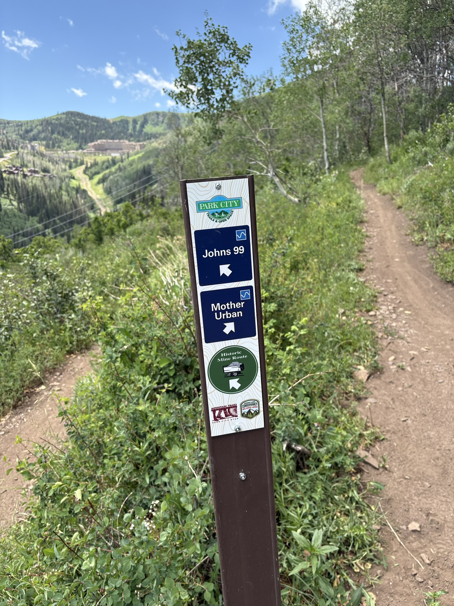
From the Silver King Mine, walk east on the doubletrack dirt service road past the abandoned electrical power substation toward the Silver King Mill 12 overlook. Continue walking east. Look for trail signs noting the Historic Mine Route and the trail named John’s 99, which will shortly cross the unpaved King Road.
As you walk slightly downhill south and west, you will experience the first sweeping views of Empire Canyon and the grand Montage Deer Valley hotel. Cross the Mother Urban 13 trail to reach the New Connector trail, where a left turn will lead to Empire Canyon — the next section is more challenging because it is a temporary gravel road, and hiking poles are recommended.
Walk downhill on New Connector Trail about one-half a mile. You’ll soon reach a dirt trail, Ontario Ridge Road, and a cluster of historic buildings, the Alliance Watchman’s Cabin 14 and the Alliance Mine15 building. Continue downhill on the dirt service road to the JM&S Co. office 16, the Explosives Magazine 17, the Daly-Judge Mill 18, John Daly in Empire Canyon 19 and the American Flag 20 Mine. About 500 yards after historic site #20, look for the Historic Mine Route wayfinding sign and the two steep steps on the left, downhill, to the OMG trail. Enjoy the shady forest trail, following the signs to the Prospect trail where you’ll pass the Daly-Judge Aerial Tram 21. This trail ends at Prospect Avenue, a paved but reasonably steep road.
05
Ontario Ridge, back to Main Street
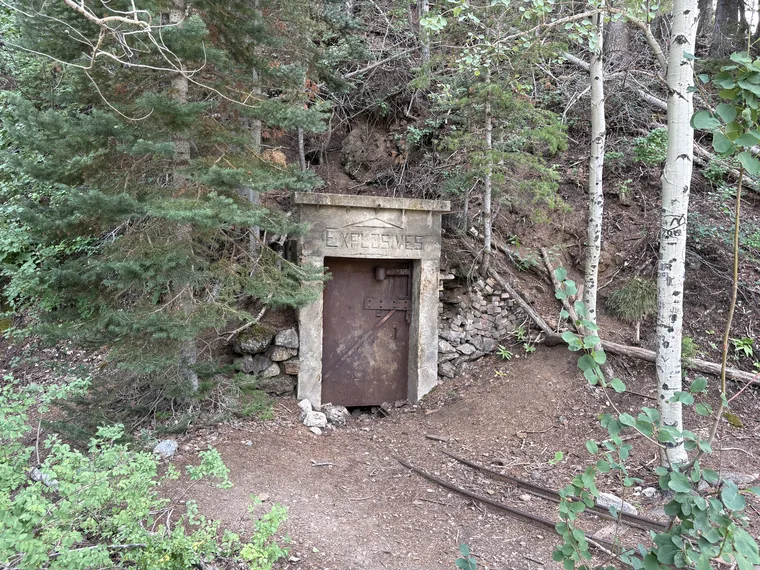 Daly-Judge Explosives Magazine in Empire Canyon
At the bottom of Prospect Avenue, turn right on Chambers Ave to walk south to the intersection of Marsac Avenue. Cross Marsac with care, minding the traffic, to see and hear historic stories 23 and 24 associated with the Ontario Mine and Mill, as well as the Judge Aerial Tram loading station.
Follow the Historic Mine Route wayfinding signs back to the short Historic Chamber’s Neighborhood trail, which starts on Hillside Avenue and connects you to upper Swede Alley. Turn left to finish the route on Main Street; about 0.3 miles north to the Park City Museum.
Your hike finishes on Park City’s Historic Main Street, lined with a range of tempting restaurants to reward yourself with lunch, a snack, or a cool drink. Public restrooms are available at Miners Park at 415 Main Street, and next to the Park City Museum at 528 Main Street.
Before You Head Out
Download the free TravelStorys audio guide
Be sure to download the free TravelStorys app that gives you a narrated tour from your smartphone. Set location to "always allow," so the content plays correctly even if your phone falls asleep — the app's map highlights your location at any time during your hike, relative to the stories at sites of historical interest.
Also viewable on desktop at travelstorys.com